

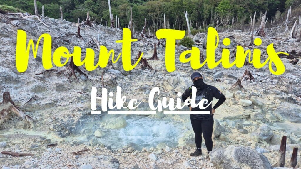
Hiking Mount Talinis is an EPIC adventure!
The trail has dense mossy forests…
Steep, steep uphills…
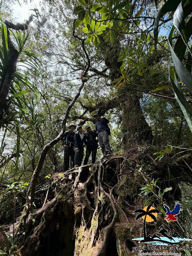
Large trees with thick roots sticking out of the ground…
A white wasteland with bubbling sulfur vents…
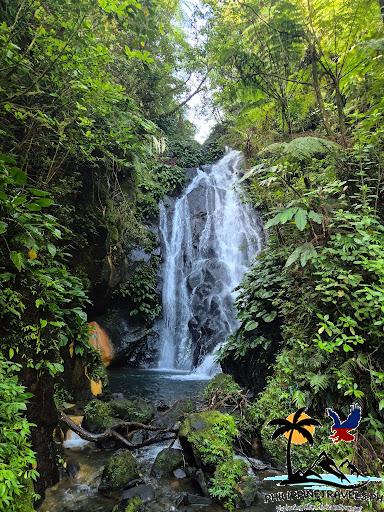
Icy cold falls that you can swim in…
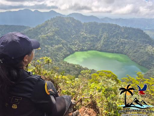
And of course, the peak with its slanting tree and amazing lake view.
So if you’re planning your next climb…
You should definitely do Mount Talinis!
In this guide, I’ll go over everything you need to know before hiking Mount Talinis, including:
- What you need to know
- Trail routes
- Tours vs DIY
- How to get there
- Fees
- Full trail walkthrough
- Some FAQs
What You Need to Know About Mount Talinis
Location: Dauin and Valencia City, Negros Oriental (near Dumaguete)
Height: 1,903 masl (6,243 ft)
Hours to summit: 6-9 hours, depending on the trail and pace
Difficulty: 6/9
Mount Talinis is a MAJOR hike.
Pinoy Mountaineer gives it a difficulty rating of 6/9.
So expect STEEP uphills and downhills.
Expect to use your hands and feet in some technical areas!
But it’s on the easier side for majors…
It’s the perfect choice if you want to do your 1st major hike.
And the pain is worth it because the views are AMAZING and so UNIQUE!
Just look at these roots!
And the view from the summit!
It usually takes 2-days, 1-night to complete.
That already includes hiking to the summit…
Swimming in the falls…
Viewing the sulfur vents…
And camping beside the eerie but beautiful lakes.
There are several freshwater sources along the trail…
But only a few when we went because it was summer, and it was HOT.
You can drink the lake water, though…
Maybe boil it first to avoid an upset stomach.
Mount Talinis Hiking Trails
Mount Talinis has 3 popular trails: the Dauin (Bediao) Trail, the Valencia (Panghilakan) Trail, and the Valencia (Apolong) Trail.
Bediao Trail passes by:
- Lake Yagumyum
- Lake Nailig
Apolong Trail passes by:
- Sulfur vents
- Twin falls
- Lake Nailig
The Panghilakan Trail passes by:
- Lake Nailig
Here’s a nice Mount Talinis hike map to help you understand the trails better.
All 3 trails meet at Lake Nailig, just below the summit.
The good news is you can mix and match which trails you go on…
You can enter through Apolong and exit Panghilakan, or vice versa.
Our group did a Bediao backtrail with a side trip to the sulfur vents and twin falls in Apolong.
We set up camp at Lake Yagumyum instead of the popular Lake Nailig campsite to make the side trips easier.
Mount Talinis Tours
The most common way to climb Mount Talinis is with a tour.
I joined a 2D1N joiner tour by Negrense Juanderer (HIGHLY recommended!). It costs php3,500/head and already includes transport (from Bacolod, Dumaguete, or anywhere in between), guide fees, and 3 meals. Basically, you get everything you need for a stress-free hike.
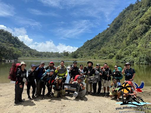
If you can’t join Negrense Juanderer’s tours, you can easily search for another group by searching “Mt Talinis joiner” on Facebook…
Or you can book a private tour if you’re a big group. Message an organizer and pick your dates.
Tours usually have a fixed itinerary…
But you can switch it up if the other joiners agree.
For example, our original plan was to side-trip to the sulfur vents on day 1. But since we were all fast hikers, we decided to switch it up and summit on Day 1, and visit the sulfur vents and falls on Day 2 instead.
How to Climb Mount Talinis DIY
Wanna go DIY?
There’s a php20/head environmental fee, and a php2,000/day guide fee (Dauin rates).
You’ll need 1 guide for every 5 hikers (day hike) or 7 hikers (overnight).
Contact the Dauin NegOR Tourism Facebook page for help arranging guides for your hike.
Here are other things you need to know if you want to DIY:
- You have to bring your own food and cooking setup.
- Most DIY hikers do a traverse (like Apolong to Bediao).
- The most popular campsite is Lake Nailig (1 hour away from the summit). But you can also camp at Lake Yagumyum or Rancho Campsite.
- The trails can be confusing, which is why a guide is required.
IMPORTANT! It’s mandatory to bring a guide. You’re not allowed to just use a map and climb by yourself.
How to Get to Mount Talinis
Mount Talinis has 2 jump-off points: Valencia and Dauin. These are around 45 minutes to an hour from Dumaguete City.
Our tour picked us up at McDo in Dumaguete City.
But if you want to DIY:
- Fly, boat, or bus to Dumaguete City.
- From Dumaguete, take a jeepney or bus to Valencia (for Apolong/Panghilakan) or Dauin (for Bediao).
- Then take a habal-habal (motorcycle taxi) to the jump-off point.
- If driving, search for “Apolong Trail jump-off” (Valencia side) or “Bediao jump-off” (Dauin side) on Google Maps.
But wait!
You need to make a quick stopover for registration and briefing.
On the Dauin side, just search “Mt Talinis logbook area” on Google Maps. I’m not sure about the exact spot on the Valencia side.
Mount Talinis Fees
| Joiner tour (includes transport, guides, and meals) | Php3,500/head (no need to pay environmental or guide fees) |
| Porter (optional) | Php150 per kilo. If above 15 kilos, there’s a php2,000 flat rate for the whole climb. |
If doing DIY (Dauin trail):
| Guide fee | php2,000/day |
| Environmental fee | php20/head |
Mount Talinis Sample Itinerary
Here’s the original planned itinerary of our group.
As I mentioned above, everyone in our group was fast, and we arrived at our campsite well before 11:30am.
That’s why we decided to switch it up and climb to the summit on the first day (note: our guides said there’s a much better chance of catching a clearing at the summit during the afternoon).
Day 1:
- 4:00 am – Meetup at MCDO Duma. (Breakfast/coffee/buy packed lunch.)
- 06:00 am – Departure to Bediao Jump-Off.
- 7:00 am – Arrive at Bediao, Dauin. (Register/briefing/pray/prepare porters.)
- 7:30 am – Start trek.
- 11:30 am – Arrive at Yagumyum Lake. (Take pictures/rest/lunch/set up tent.)
- 12:30 pm – Hike from Yagumyum to the sulfur vent and twin lakes.
- 4:00-4:30 pm – Arrive back at Lake Yagumyum. (Rest/dinner/socials)
- 9:00 pm – Lights off
Day 2:
- 5:00 am – Wake up. (Prepare/coffee.)
- 5:30 am – Hike to Lake Nailig.
- 7:30 am – Arrive at Lake Nailig. (take pictures/rest 30 mins/eat packed breakfast.)
- 8:00 am – Start trek to the summit.
- 9:00 am – Arrive at the summit. (Pictures/rest 30 mins.)
- 9:30 am – Descend back to Lake Yagumyum
- 12:30 pm – Arrive at Lake Yagumyum. (Lunch/pack up/rest for 1 hour.)
- 1:30 pm – Start trek descend.
- 4:00-4:30pm – Arrive at the Bedjao jump-off.
What to Expect on the Mount Talinis Trail
Mount Talinis trail is so diverse!
The Dauin trail starts with some uphill grassy land.
Then it turns into a thick forest with a steep ascent.
After about 3 hours of pure uphill, you’ll reach Lake Yagumyum.
The campsite is a bit small, but you can always find space for your tent…
You can even pitch it right beside the lake (just be warned – it gets really cold there at night!)
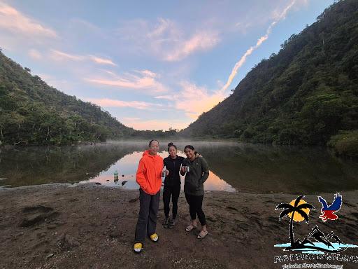
The hike to Lake Nailig has some of the most unique terrain.
You’ll have to climb over thick, exposed tree roots.
It feels like climbing Jack’s Beanstalk.
Just look at this!
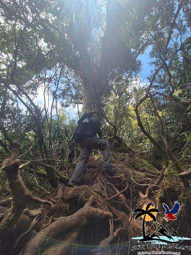
Then you’ll go through some mossy (and slippery) rocks…
Warning!
Make sure to watch your head as there are low-hanging trees along the trail…
I know because I bumped into one pretty hard!
After 2 hours of that, you’ll reach Lake Nailig.
The lake and campsite are much bigger here.
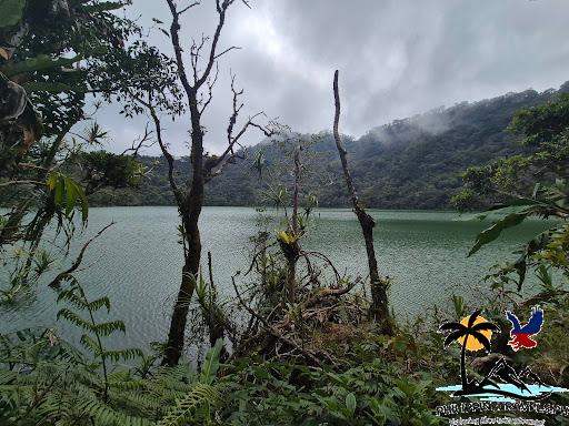
From there, it’s a 1-hour ascent to the summit.
For me, this was the toughest section.
It’s super steep and has technical parts where you need to scramble up.
But it’s SUPER WORTH IT!
It’s like it’s made purely from tree roots.
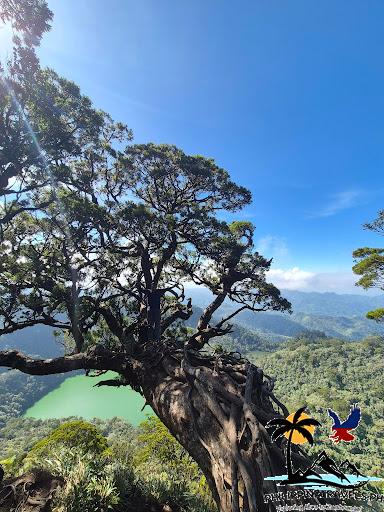
And if you’re lucky, the clearing shows a full view of Lake Nailig and a smaller one nearby, along with all the surrounding vegetation.
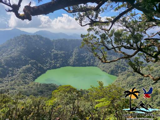
For the sulfur vents and falls, you take a side trail from Lake Yagumyum.
It’s a very steep downhill.
You really have to watch your step and hold onto branches.
Just make sure you don’t grab one of these guys!
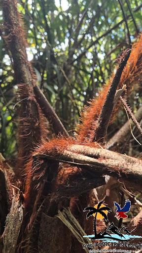
You’ll reach an area with really tall grass, which leads to a white wasteland.
Seriously…
Everything is dead.
A big contrast to the lush green around it.
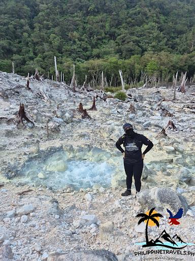
Then you continue on and reach the rivers.
You’ll need to do some river crossing.
Nothing too hard…
Just make sure you watch your step.
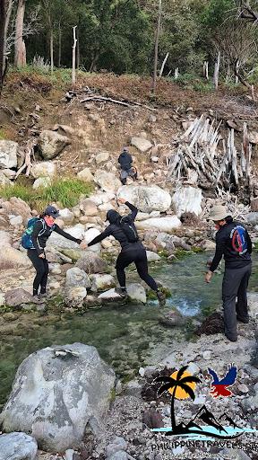
Finally, you reach the falls with black rocks…
And you can swim to cool off from the heat of the day!
FAQs – Frequently Asked Questions About Mount Talinis
Who Do I Contact to Hike MT Talinis?
You can contact Third Canete (The Negrense Juanderer) for joiner or exclusive tours. For DIY climbs, contact the Dauin NegOR Tourism Facebook page for a guide.
Is MT Talinis Good for Beginners?
Yes and no.
It’s a tough hike. But it’s also one of the easier major hikes in the Phils. If you’re healthy and exercise, you can do it.
I actually highly recommend MT Talinis for a first major hike. The scenery is worth it!
How Many Hours To Hike MT Talinis?
It takes around 6 to 9 hours from the jump-off to the summit. But most hikers make it a 2-day, 1-night trip to see more of the mountain.
Do I Need A Guide for Mount Talinis?
Yes. Guides are mandatory. There are many paths on the mountain, so it’s easy to get lost without a guide.
Is Mount Talinis the Highest Mountain in Negros Oriental?
Yes. Mount Talinis stands 1,903 meters above sea level. It’s also the second-tallest mountain on Negros Island, right after Mount Kanlaon.
What Is MT Talinis?
MT Talinis is a complex volcanic mountain. It’s also called Cuernos de Negros (Horns of Negros) for its horn-like twin peaks.
Is Mount Talinis an Active Volcano?
It’s classified as a potentially active volcano. It doesn’t have any records of erupting, but it has some activity, like steam vents and sulfur areas.
Conclusion: Should You Climb Mount Talinis?
Yes!
If you’re up for the challenge…
I say do it.
It’s my FAVORITE hike ever!
Some hikes are painful with no view…
Others have epic views, but not that challenging…
Mount Talinis is both!
So what are you waiting for?
Use this guide to plan your next climb in the awesome Mount Talinis!