
Hiking Mount Napulak is a LOT of fun.
Not only are the views from the top breathtaking, but you’ll also encounter many exciting features on the way up.
From the farmland to the aqueducts, the wild berries and so much more!
In this guide, I’ll go over everything you need to know before hiking Mount Napulak including:
- What you need to know
- A full walkthrough of the trail
- How to get to Mt. Napulak (public transport and DIY)
- Budget
- Itineraries
- Some FAQs
- Helpful resources
So let’s dive (or should I say, climb) in!
Visiting Ilo-Ilo soon? Check out my tourist spots post or my travel guide for more tips!
What You Need to Know About Mount Napulak
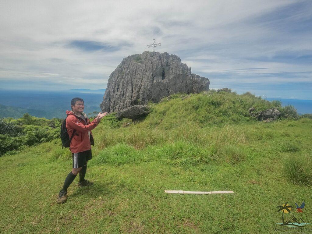
Mount Napulak is the most popular mountain in Ilo-Ilo.
It gets its name from the large nipple-shaped limestone rock sitting at the summit (Napulak means nipple in the local dialect).
Found in Igbaras, just an hour and a half away from Ilo-Ilo city, this mountain is perfect for a quick day hike.
But!
For the adventurous, it’s also a great place for overnight camping.
With plenty of grass and a water source not too far away, Mt. Napulak is an awesome place to spend the night.
Facts About Mt. Napulak
Height: 1,239 masl (4,065 ft.)
Hours to summit: 2 (expert), 3-4 (healthy), 5-8 (beginner)
Difficulty: 4/9
Trail Class: 1 – 5 (Mostly 1-3, but 5 to climb the rock)
Standing 1,239 meters above sea level, Mt. Napulak is great for beginners!
Pinoy Mountaineer gives it a difficulty rating of 4/9.
This means that while there are steep and tiring portions, it’s nothing a relatively healthy person can’t manage.
The only difficult part of the hike is when you reach the summit and want to climb the large limestone rock.
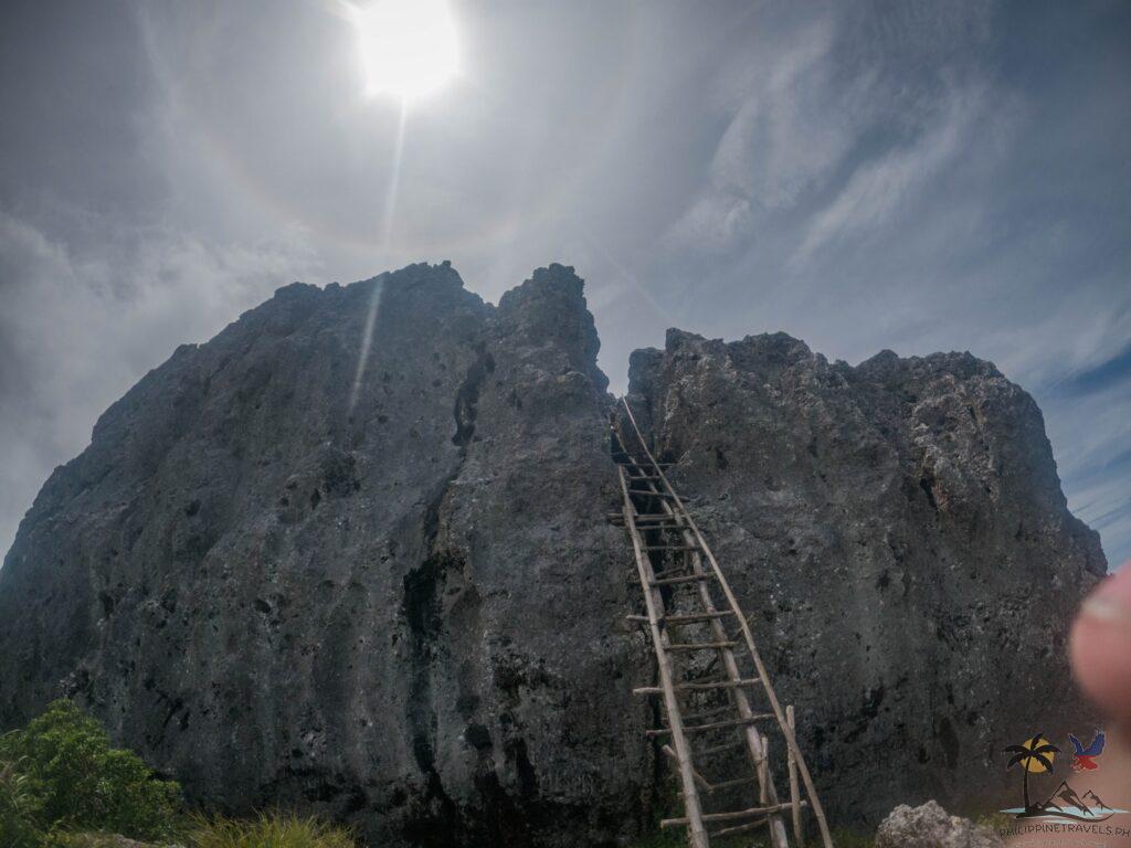
There is a makeshift wooden ladder, but it doesn’t go all the way up to the cross.
To get there, you’re going to have to carefully scramble up the jagged rocks.
If you’re scared of heights, this part can be difficult for you. Just listen to your guide’s instructions, and you’ll get to the top just fine.
Reaching the summit takes a total of 2 hours if you’re a seasoned mountaineer, 3-4 hours if you’re healthy, and probably around 5-8 hours if you don’t exercise (I reached the summit in 3.5 hours).
What to Expect in the Mt. Napulak Trail
Mount Napulak’s trail is full of things to see!
Here’s what you can expect:
- Farmland
- Steep uphill
- Aqueducts
- Stream crossings
- Last water source
- Grassy hills (steep uphill)
- Wild berries
- Top of the mountain!
- Climb the Napulak rock
It starts with some farmland.
You’ll see some houses, some crops, and maybe a friendly carabao or two.
Then you’ll get to the first steep ascent.
After about an hour, you’ll reach the relatively-flat forested area, where you’ll also find one of Mt. Napulak’s most unique features – the aqueducts!
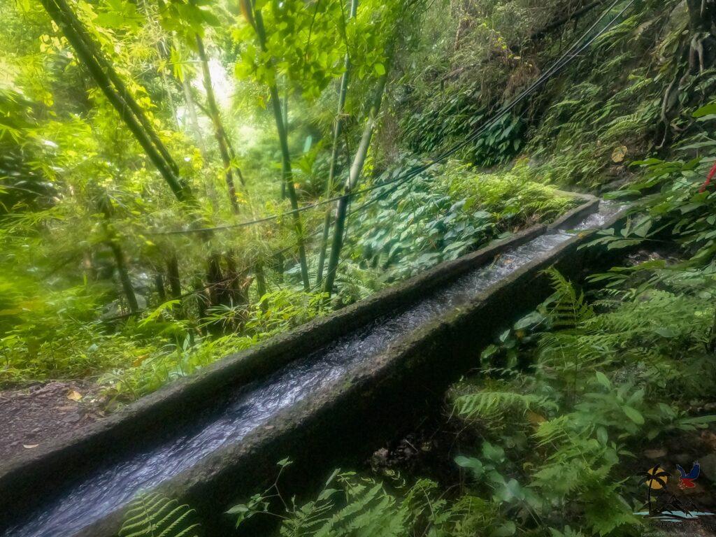
The aqueducts hug the mountain.
They were built long ago to bring water to the farmland below.
The path here is quite narrow, so you’ll have to use a bit of balance treading on the rocks between the aqueducts on your right and a steep drop on your left!
Or… if you don’t mind your shoes getting wet, you could just walk on the flowing water for about 30 – 45 minutes.
After the aqueducts, you’ll find several stream crossings.
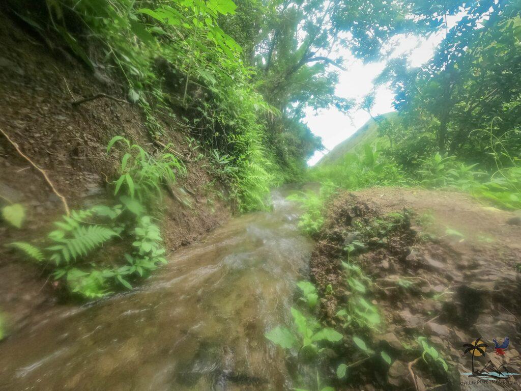
These are small streams that you can sometimes just skip over. No big river crossings here!
If you’re lucky, this is where you’ll find the world’s BIGGEST flower – rafflesia – blooming. Sadly, it wasn’t the season when I visited.
There are also water sources, 3 to be exact, in the forested area.
This is great. It means you don’t have to pack a lot of water, which will only weigh you down.
Just bring one tumbler and refill along the way!
After 1-2 hours in the forested area, you’ll get to the last water source. Be sure to fill up because it’s time for the grassy hills!
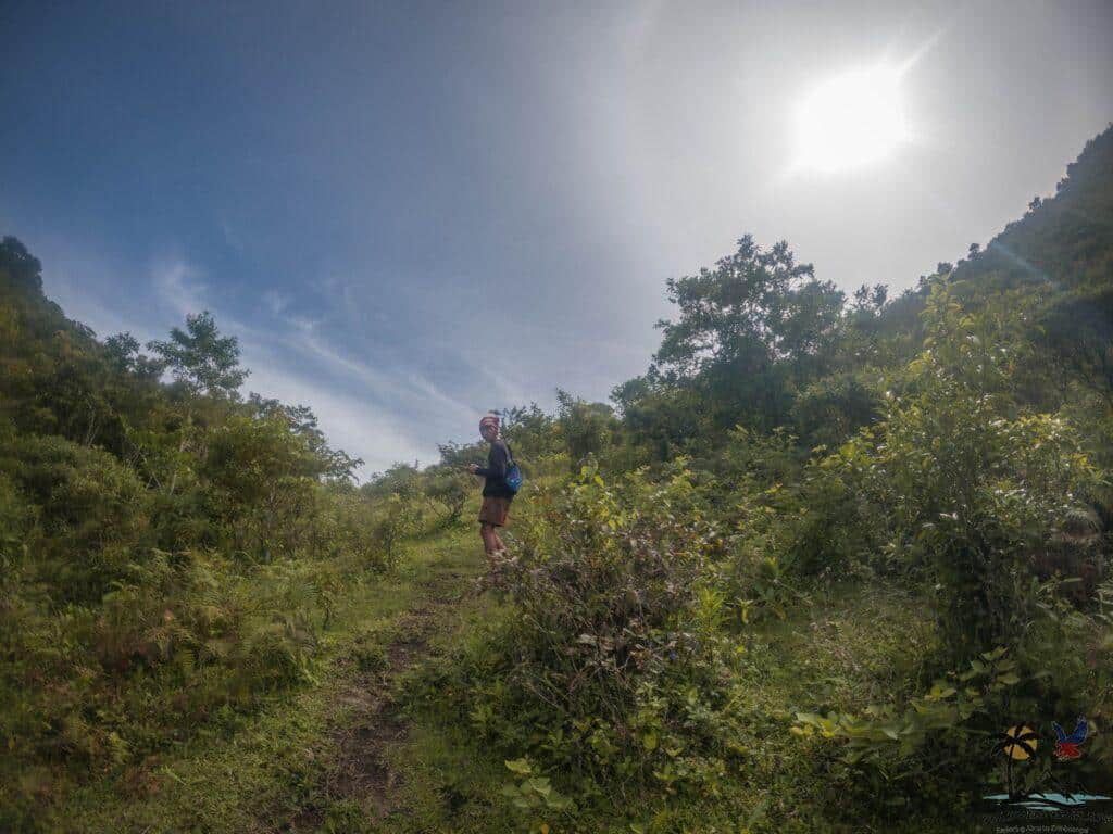
This area is pretty steep, and there are no trees, so get ready for a hot 1-hour ascent.
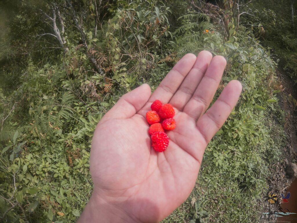
If you wanna escape the sun, you’ll have to hide beneath the shrubs.
The good news is that these aren’t ordinary shrubs, they have wild berries that you can eat!
After climbing for around 30 minutes to an hour, you’ll reach one last hill.
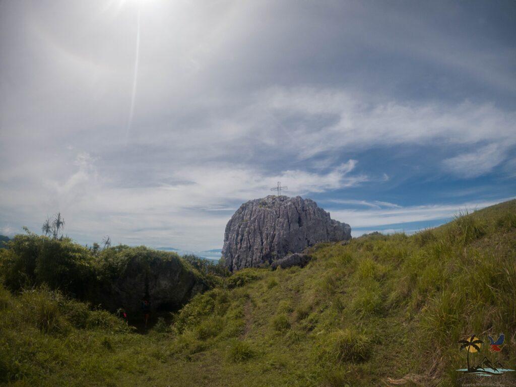
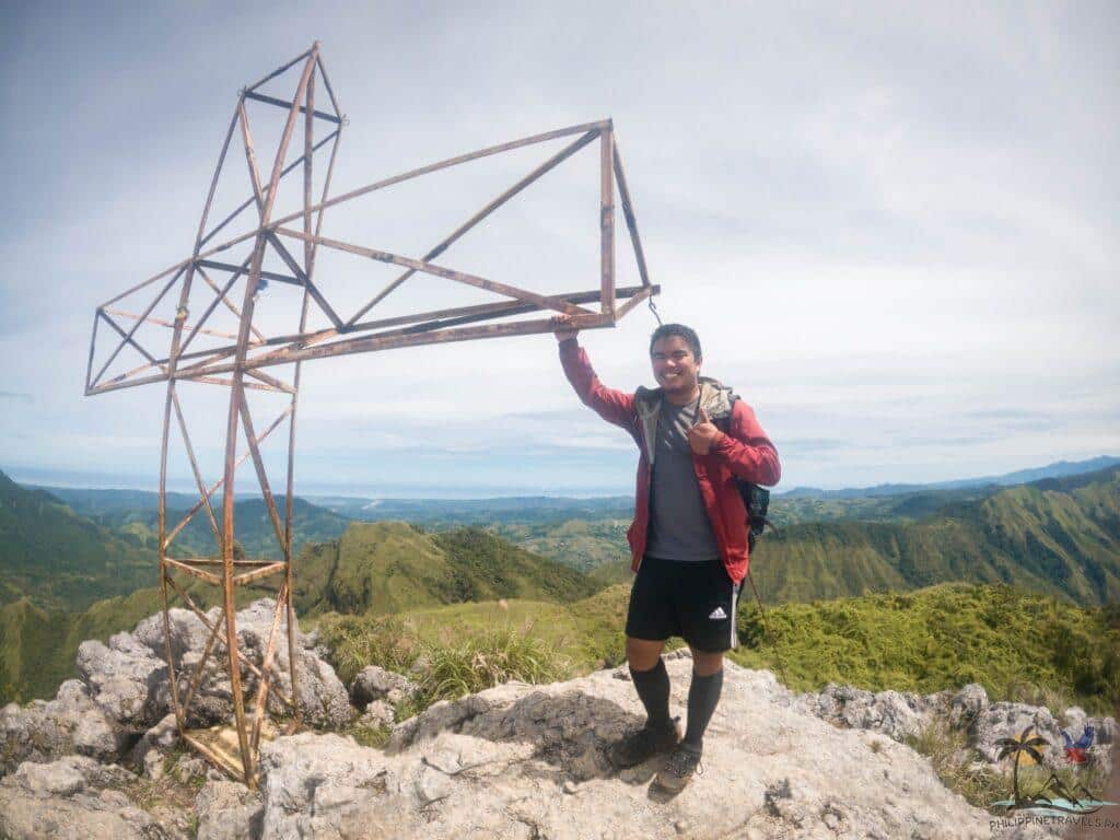
And just as you go over that hill, you’ll be greeted by the majestic rock on top of Mt. Napulak!
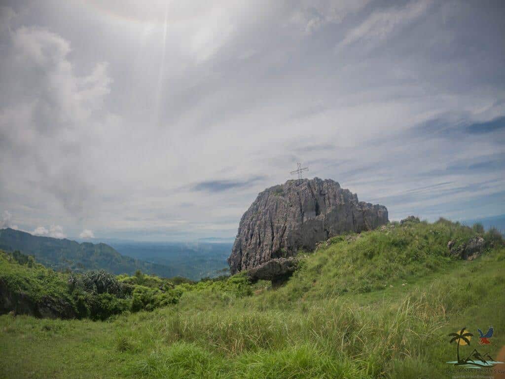
It almost comes out of nowhere.
Several other limestone rocks are sitting around here.
None of them are as big as the nipple rock, but they make a great place to shelter from the sun and eat some breakfast.
Then it’s time for the most challenging part of the hike!
Climbing the rock!
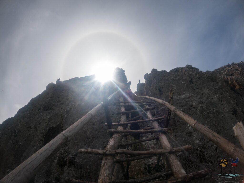
There is a makeshift wooden ladder that’ll get you about halfway to the top.
From there, it’s a slow, careful scramble until you get to the metal cross perched at the top of the rock.
Up there, you’ll get a stunning 360 view of Ilo-Ilo’s coast, Antique’s mountain ranges, and even Mt. Kanlaon in Negros in the distance!
Sidetrip to Limbaong Falls
As you’re descending from Mt. Napulak, you can ask your guide for a short side trip to Limbaong Falls.
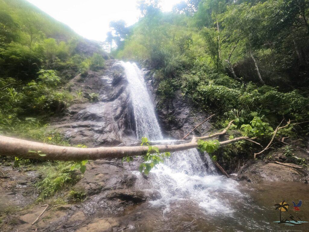
It’s a nice little fall, around 15 minutes off the trail from the aqueduct area.
The climb down to the falls is easy, but going back to the trail is a steep hike!
How to Get to Mount Napulak
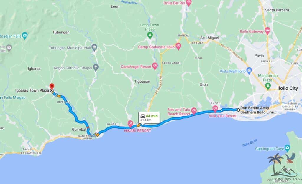
Mt. Napulak is found in Igbaras, about 1.5 hours away from Ilo-Ilo City.
To get there, you can ride an Igbaras-bound jeepney from the Mohon terminal.
Have the driver drop you off at the Igbaras tourism office.
You can sign up for the hike there. And the officer can help you find a guide and arrange a habal-habal (motorcycle taxi) to take you to the jump-off point.
Contact the Igbaras tourism office on Facebook for more info!
How to Get to Mt. Napulak DIY
If you’re renting a car or a motorbike, you can search for “Igbaras town plaza” in Google Maps, then ask around where the tourism office is. Or… you can go full DIY and skip the tourism office completely.
If you want to go full DIY, I highly recommend finding a local guide first.
You can check out this Facebook group for that.
The group is run by sir Ven, a local who helped me a LOT in finding a guide!
Once you’ve arranged stuff with Ven or another local guide, you can drive your car or motorbike straight to the jumpoff point in Brgy Bagay.
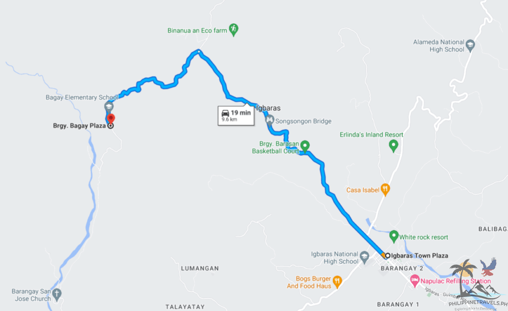
The jumpoff doesn’t show up in Google Maps, but you can search for “Brgy Bagay Plaza.”
Just ask the locals for the jump-off once you get there!
Mount Napulak Budget
Here’s how much you’ll spend in Mt. Napulak!
- Jeepney (Mohon to Igbaras) – php60
- Registration fee – php25
- Environmental fee – php25
- Habal-habal (To and from jumpoff) – php400
- Guide fee – php1,000
- Jeepney (Igbaras to Mohon) php60
Total: php1,570
If you’re doing DIY, here’s roughly how much you’ll spend:
- Motorbike Rental – php500
- Motorbike gas – php100
- Registration fee – php25
- Environmental fee – php25
- Guide fee – php1,000
Total DIY: php1,650
Mt. Napulak Itinerary
6:00am – First jeepney from Mohon to Igbaras
7:00 am – Arrive at Igbaras tourism office / register
7:20 am – Arrive in Brgy Bagay jumpoff / start hike
8:30am – Reach aqueducts
9:30 am – Last water source / final assault
10:30am – Mt. Napulak summit! / Brunch
11:30 am – Start descent
1:00 pm – Side trip to Limbaong falls
3:00pm – Arrive at Brgy Bagay jumpoff / ride habal-habal back to tourism office
3:20 pm – Arrive at tourism office / wait for jeepney
4-5 pm – Back in Ilo-Ilo City
Mt. Napulak DIY Itinerary
5:00 am – Leave Ilo-Ilo City
6:30am – Arrive in Brgy Bagay Jumpoff / Start hike
7:30am – Reach aqueducts
8:30 am – Last water source / final assault
9:30 am – Mt. Napulak summit! / brunch
10:30 am – Start descent
12:00 pm – Side trip to Limbaong falls
1:30 pm – Arrive at Brgy Bagay Jumpoff
From here, you can head back to Ilo-Ilo and arrive at around 3 pm.
Or, you can do what I did and visit Nadsadjan Falls as well!
My day continued:
2:00 pm – Lunch in Igbaras 7/11
2:30 pm – Start driving to Brgy Passi
3:00 pm – Arrive at Nadsadjan Falls jumpoff / start trek
3:30 pm – Get lost because you don’t have a guide 😂
4:00 pm – Finally find the falls!
5:00 pm – Find your way back to jumpoff / start the drive back to Ilo-Ilo City
6:30 pm – Arrive back in Ilo-Ilo city
FAQs – Frequently Asked Questions About Mt. Napulak
Do I Need a Guide for Mt. Napulak?
Yes. There are plenty of paths on the mountain. Without a guide, you can get lost.
Aside from that, you’ll also be supporting the locals living on the mountain!
How Tall is Mt. Napulak?
Mt. Napulak stands 1,239 meters above sea level (or 4,065 feet!)
How Long Does it Take to Climb Mt. Napulak?
Getting from the jump-off to the summit takes an average of 4-6 hours. 2 hours for seasoned mountaineers, 3-4 for active people, and 5-8 for beginners.
Where is Mt. Napulak Located?
Mt. Napulak is found in Igbaras in Ilo-Ilo, about 1.5 hours away from Ilo-Ilo city.
What is the Difficulty Level of Mt. Napulak?
Pinoy Mountaineers gives Mt. Napulak a difficulty of 4/9, with a trail class of 1 – 5.
Is Mt. Napulak the Tallest Mountain in Ilo-Ilo?
No. The tallest mountain in Ilo-Ilo is Mt. Baloy, which is found right on the border of Ilo-Ilo and Antique.
Is Mt. Napulak Good for Beginners?
Yes! Hiking Mt. Napulak is great for beginners because it’s challenging but still very doable even for people who have never climbed a mountain before.
Mt. Napulak Helpful Resources
Here are some useful resources for planning your trip to Mt. Napulak:
- Igbaras Tourism Office Facebook Page (Contact before visiting!)
- Mt. Napulak Facebook Group (DIY find a guide here)
- Mt. Napulak brochure by the Igbaras Tourism Office
Conclusion: Should You Climb Mt. Napulak?
It depends!
I feel like two types of people can really appreciate Mt. Napulak:
- Mountaineers who already LOVE climbing mountains, and
- People who are curious about mountaineering
If you’re visiting Ilo-Ilo on vacation, a trip to Igbaras might not fit into your schedule.
There are plenty of other things better suited to casual travelers like visiting the city’s churches, Garin Farm, Islas de Gigantes, or any of these 17 Ilo-Ilo tourist spots.
But if you love mountains and nature, then what are you waiting for?
Use this guide to plan your trip to Ilo-Ilo’s most famous mountain!
Looking for more Ilo-Ilo travel tips? Check out my Ilo-Ilo travel guide here!